

Lough Hyne was designated Europe’s first statutory Marine Nature Reserve in 1981. Located on the West Cork coast, it is a highly-sheltered seawater lake surrounded by cliffs, beaches, boulders and salt-marshes.
The Lough is connected to the Atlantic Ocean via a narrow, shallow constriction known as the “Rapids”. Water floods in through the Rapids for 4 hours and ebbs for 8.5 hours. This contributes to the wide variety of marine plants and animals that are found at Lough Hyne.
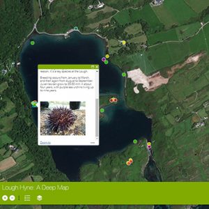
- Explore our interactive ‘deep map’ of Lough Hyne. Layer by layer, uncover the rich maritime heritage of the area through seven different, but interrelated themes: art, biology, environment, folklore, history, literature and music.
- Instructions: Exploring the Lough Hyne Deep Map